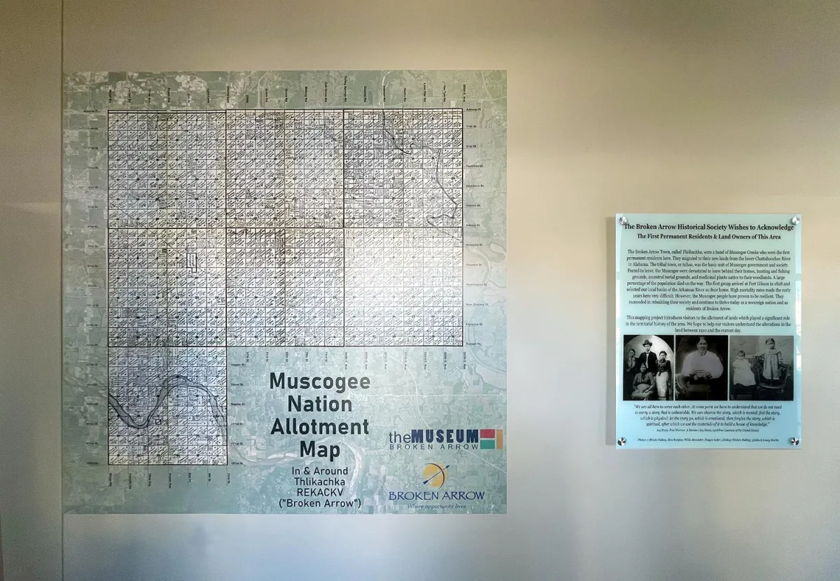
Interactive Map Brings Mvskoke Allotments to Life During Native American Heritage Month
The preservation of Native American history takes a bold and innovative step forward as a groundbreaking interactive map garners widespread attention during Native American Heritage Month. Created by the Museum Broken Arrow, this tool invites users to explore the original Mvskoke (Muscogee Creek) allotments overlaid on the modern-day landscape of the greater Tulsa area.
This project holds profound significance for anyone invested in Native American heritage and land history. It sheds light on the lasting impacts of the Dawes Act of 1887, a federal policy that dismantled communal tribal lands, assigning individual allotments instead. This policy disrupted the traditional land practices of the Five Civilized Tribes—the Mvskoke, Cherokee, Choctaw, Chickasaw, and Seminole Nations—fundamentally altering their relationship with the land and creating ripples that continue to affect Native communities today.
What sets this interactive map apart is its seamless integration of historical and contemporary data. It overlays allotment boundaries from the early 20th century with today’s streets and landmarks, enabling users to pinpoint the original ownership of any given plot of land. Whether you’re a Native American tracing family roots or a local resident curious about the history beneath your feet, this map opens a unique window into Oklahoma’s layered past.
The map draws on detailed data from Hastain's Township Plats of the Creek Nation, a 1910 publication documenting allotment parcels in remarkable detail. This invaluable resource allows users to identify who originally owned land parcels, whether Native Mvskoke citizens or Freedmen. By including Freedmen allotments, the map highlights the diverse histories intertwined with the Mvskoke Nation and honors the complexity of this shared past.
For Native Americans, particularly those researching family histories, this map is more than a tool—it’s a bridge to the past. It provides context for the enduring challenges faced by Native communities as they navigate historical trauma and reclaim their stories. For genealogists, educators, and casual history enthusiasts, the map transforms abstract history into something tangible and deeply personal.
This project also serves as a call to action for broader public understanding of Native land histories. As users explore the map, they are reminded of the resilience of the Mvskoke people and the ongoing significance of land in Native cultures. The Museum Broken Arrow has not only preserved history but made it accessible in a way that sparks curiosity, fosters education, and deepens respect for Native heritage.
As this interactive map gains attention, it becomes a symbol of how technology and history can merge to empower communities and ensure that stories of the past remain vibrant and relevant today. By connecting modern residents to the original stewards of the land, it reinforces the importance of honoring the legacy of the Native nations who have called Oklahoma home for generations.
Source:
Museum Broken Arrow, Hastain's Township Plats of the Creek Nation (1910).
